
See your property clearly Protect it confidently
From proactive wildfire mitigation and construction oversight to stunning real estate visuals, we provide the actionable data you need to make smarter decisions about your greatest assets. We’re your local, veteran-owned drone experts serving the Steamboat Springs community and surrounding areas.

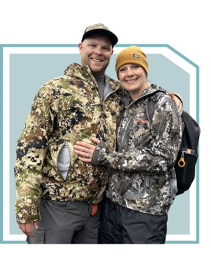
Your Project is in Experienced Hands
Premium Drone Services You can count on
Precision survey
Our precision survey operations deliver sub-centemeter positional accuracy using RTK and PPK correction methods. We capture up to 100 acres per hour and provide full 2D and 3D deliverables within 5 business days, formatted for GeoTIFF, LAS, or CAD workflows to integrate seamlessly with your engineering systems.
Search & Rescue Support
In critical situations, our drones serve as a powerful force multiplier for first responders. We provide rapid deployment for real-time situational awareness over vast or hazardous terrain, improving search efficiency and delivering vital intelligence to ground crews.
Land Inspection
Stagecoach Drone Services has surveyed more than 25,000 acres of ranch, agricultural, and utility right of ways, providing high-resolution orthomosaic imagery and detailed condition reports. Each inspection achieves sub centimeter level accuracy using RTK-enabled UAS for reliable, decision-ready data.
Thermal Inspection
Using advanced thermal sensors, we see what the naked eye can't. We safely detect heat loss in buildings, identify faulty solar panels, and pinpoint electrical hazards, providing critical data for proactive maintenance and safety.
Infrastructure & utility inspections
With over 2000 miles of transmission and distribution corridors inspected, we specialize in high-resolution asset imaging. Our inspections identify corrosion, line sag. and vegetation encroachment early. We are helping clients maintain safety, compliance, and reliability. All missions are 100% incident-free since program start.
Event & Promotional
Elevate your story with breathtaking aerial videography. We capture cinematic, high-resolution footage for promotional materials, special events, and commercial properties, delivering a dynamic perspective that captivates your audience.
3d modeling & digital twins
Transform your physical site into a precise digital asset. We create survey-grade 3D models and 'digital twins' that empower architects, engineers, and builders to track progress, verify designs, and make more informed planning decisions.
Ranch & Property overview mapping
Understand your land like never before. We generate a complete, high-resolution map of your entire ranch or large property, providing invaluable documentation for land management, infrastructure planning, and insurance purposes.
Construction documentation & survey
Keep your project on schedule and budget with regular, high-resolution aerial updates. We deliver the precise data you need to monitor progress, verify work with stakeholders, and maintain a complete, verifiable record of your build.
Wildfire Vegetation Mitigation
Satisfy your insurance requirements with the essential 'before and after' mitigation proof they demand. Our advanced analysis also maps high-risk vegetation, giving you a clear, data-driven plan to protect your home and investment.
real estate development & survey
We help developers sell the vision long before breaking ground. Our stunning aerial surveys and visuals showcase the property's full potential and key features, creating powerful marketing materials to attract investors and buyers early in the process.
Real estate photography
Make your listing unforgettable in a competitive market with stunning aerial photography and video. We capture the full beauty and scope of your property to attract more qualified buyers and help you secure the best possible offer.

Ready to see your Property from a new perspective?
Every project is unique. Let’s have a simple, no-jargon conversation about your goals. We’ll listen to your needs and provide a clear, straightforward quote to get the job done right. Fill out the form to get started with a free consultation and quote.
Delivering Peace of mind Stories of Success & Confidence
Join the Conversation
Your feedback helps your neighbors make confident decisions about protecting their property. We’d be grateful if you’d read our reviews or share your own experience on Google.

Donec sollicitudin molestie malesuada. Mauris blandit aliquet elit, eget tincidunt nibh pulvinar a. Vestibulum ante ipsum primis in faucibus orci luctus et ultrices posuere cubilia Curae; Donec velit neque, auctor sit amet aliquam vel, ullamcorper sit amet ligula. Quisque velit nisi, pretium ut lacinia in, elementum id enim. Vivamus magna justo, lacinia eget consectetur sed, convallis at tellus.
-Wilbur

Mauris blandit aliquet elit, eget tincidunt nibh pulvinar a. Donec sollicitudin molestie malesuada. Nulla quis lorem ut libero malesuada feugiat. Nulla quis lorem ut libero malesuada feugiat. Vivamus magna justo, lacinia eget consectetur sed, convallis at tellus.
Quisque velit nisi, pretium ut lacinia in, elementum id enim. Lorem ipsum dolor sit amet, consectetur adipiscing elit. Donec rutrum congue leo eget malesuada. Curabitur arcu erat, accumsan id imperdiet et, porttitor at sem. Curabitur non nulla sit amet nisl tempus convallis quis ac lectus.
-Piglet
Past Projects Our Work in Action
At Stagecoach Drone Services, we bring the sky to your side. From land inspections and precision surveys to LiDAR mapping and real estate photography, our drones capture the details that matter most. Every flight is planned with care, accuracy, and a bit of adventure to help you see your project in a whole new way.