
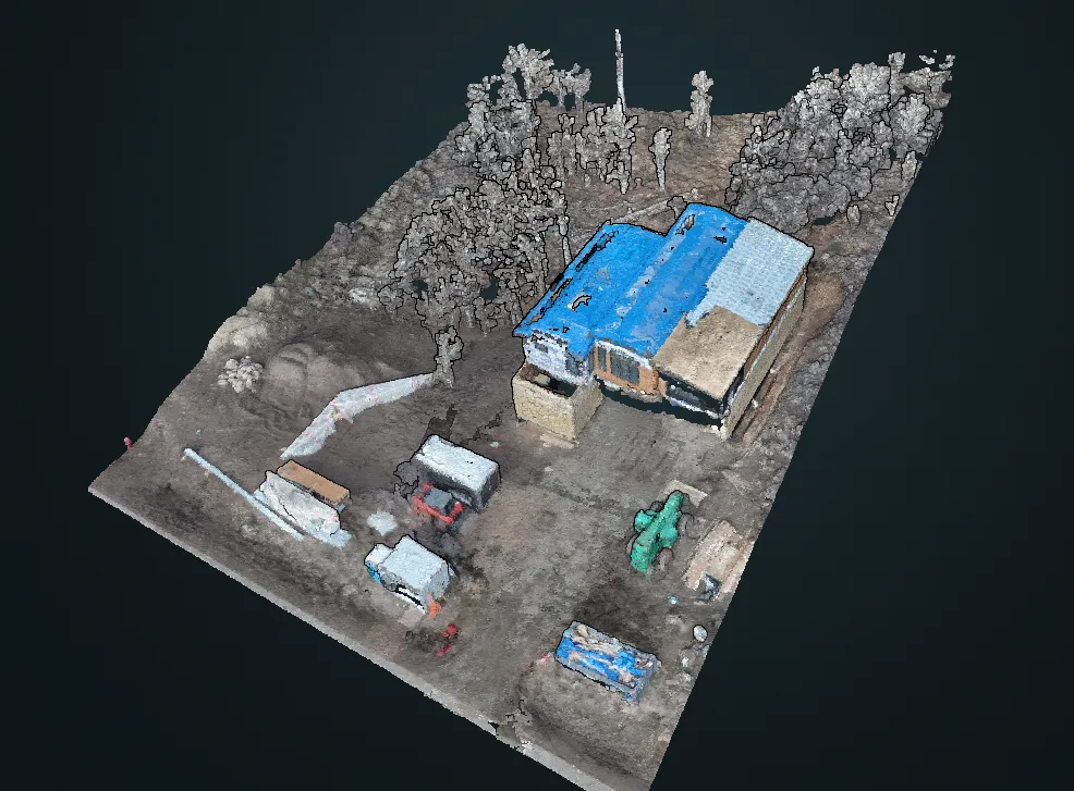
Construction documentation and survey Track your project's progress with unparalleled accuracy and detail
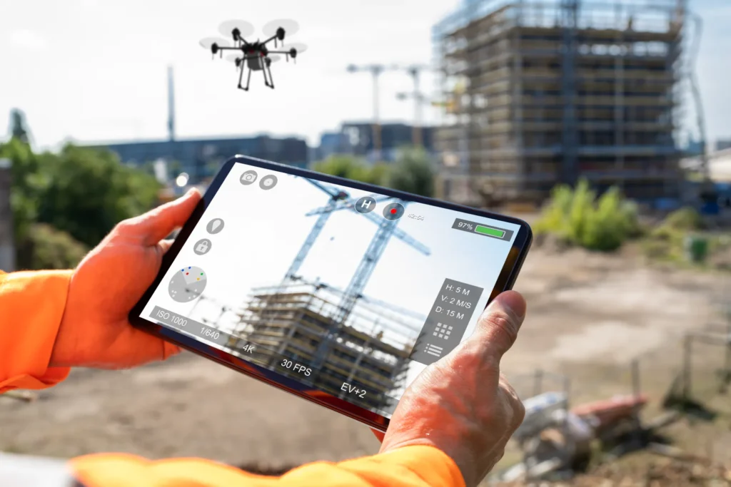
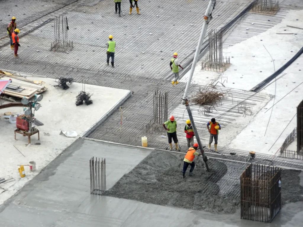
Keep your construction project on schedule and on budget with comprehensive aerial documentation. We provide regular, high-resolution visual updates, 3D mapping, and precise survey data. This allows you to monitor milestones, verify work, and communicate progress clearly with stakeholders, whether you’re on-site or across the country. Our detailed reports give you a complete, verifiable record of your build from groundbreaking to completion, ensuring transparency and accountability.
Progress
Tracking
Our high-resolution imagery and 3D models provide a verifiable visual record, allowing you to monitor construction milestones and ensure accountability from your contractors through every phase.
Data-Driven
Reporting
We deliver precise survey data and orthomosaic maps, giving you actionable insights for site management, inventory tracking, and accurate as-built documentation for stakeholders and financial institutions.
Proactive Risk Mitigation
Identify potential issues like erosion or safety compliance from an aerial perspective. Early detection helps you mitigate risks, prevent costly delays, and keep your entire project on schedule.
See how we can streamline your next construction project
Wildfire vegetation mitigation photography Proactively protect your home and property from wildfire threats
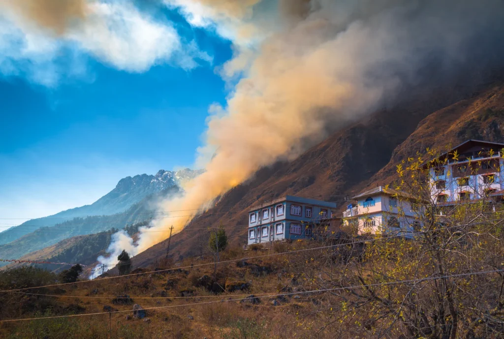
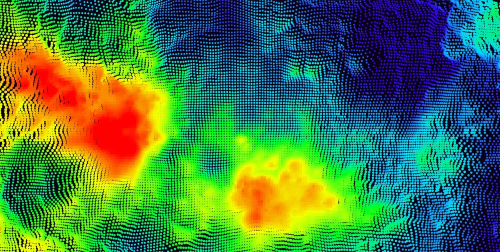
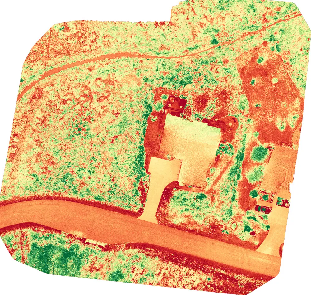
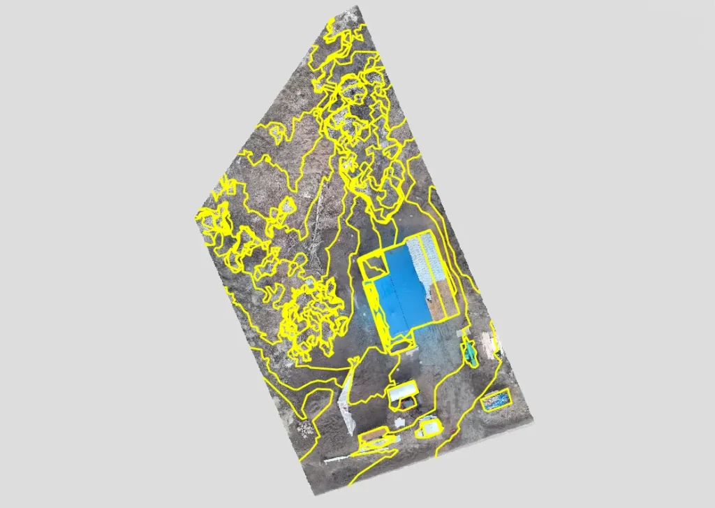
In our community, fire mitigation is essential. We partner with homeowners and HOAs to provide the critical ‘before and after’ documentation required by insurance companies. Using advanced vegetation health analysis, we create detailed maps that identify high-risk areas. This data empowers you to take targeted action and provides undeniable proof that the mitigation work has been completed, helping you secure your policy and protect your investment.
Vegetation Health Analysis
Our specialized sensors create detailed maps showing plant health, pinpointing dead or dry vegetation that poses the highest fire risk and needs immediate attention for effective mitigation.
Insurance-Ready Documentation
We provide the crucial 'before and after' visual evidence that insurance carriers require, delivering a comprehensive report that proves your mitigation work is complete and compliant with policy standards.
Interactive
Before & After
Through your client portal, access an interactive slider tool that vividly showcases the difference your mitigation efforts have made, perfect for HOA and insurance company presentations.
See how we can streamline your next fire mitigation project
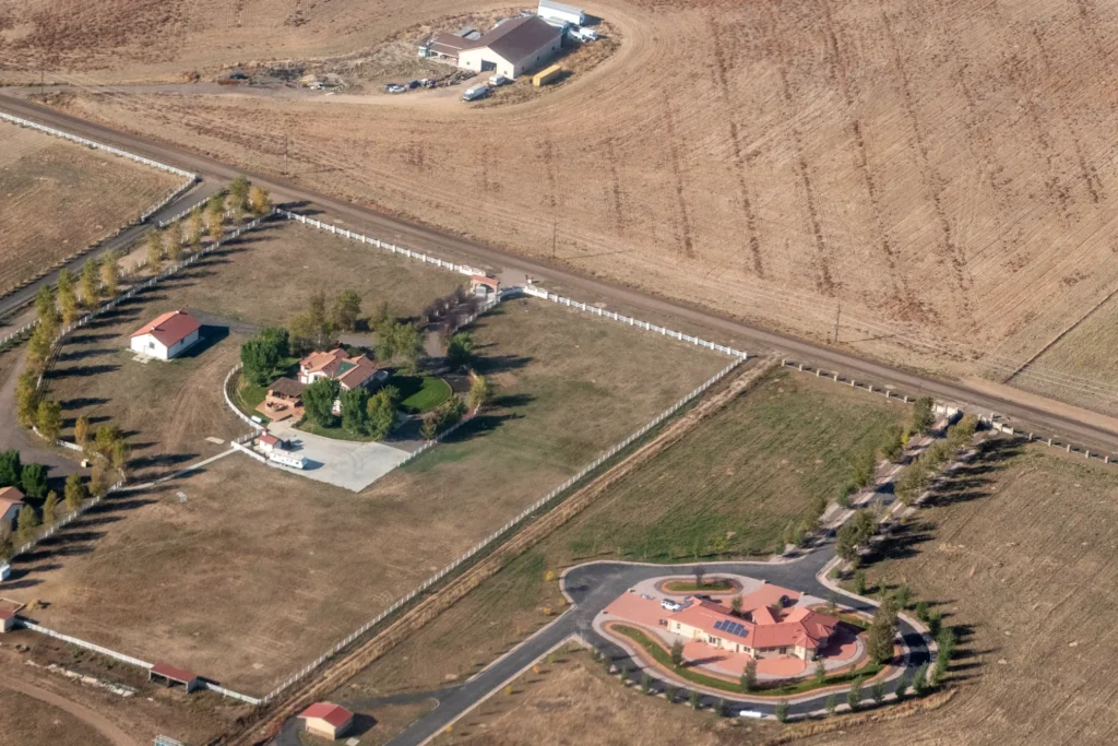
Real Estate Development & Survey Showcase your development's potential from a captivating perspective
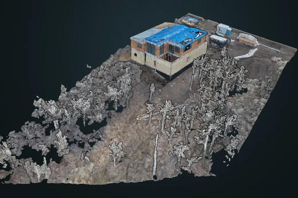
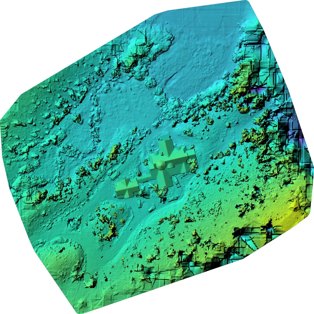
For developers, bringing a vision to life requires both precision planning and powerful marketing. Our aerial services support your project from the ground up, delivering precise survey data for volumetric measuring and specific property measurements to ensure your site plan is built on a foundation of accuracy. This same data is then transformed into stunning visuals that highlight the property’s layout and key features, creating ideal content for marketing materials and investor updates. We give you the data to build it right and the visuals to sell it fast.
Compelling
Marketing
Visuals
Generate buyer excitement with stunning aerial videos and photos that showcase the property's potential, key features, and breathtaking views, perfect for websites, brochures, and investor presentations.
Context &
Planning
Our aerial surveys provide a complete overview of the land, topography, and surrounding area, data that is invaluable for site planning. We provide specific property measurements and calculate precise volume metrics, ensuring a more accurate and efficient development plan.
Clear Stakeholder Updates
Keep investors and partners informed with clear visual progress reports. Our aerial documentation makes it easy to demonstrate milestones and effectively communicate the project's vision and status.
See how we can streamline your next real estate project
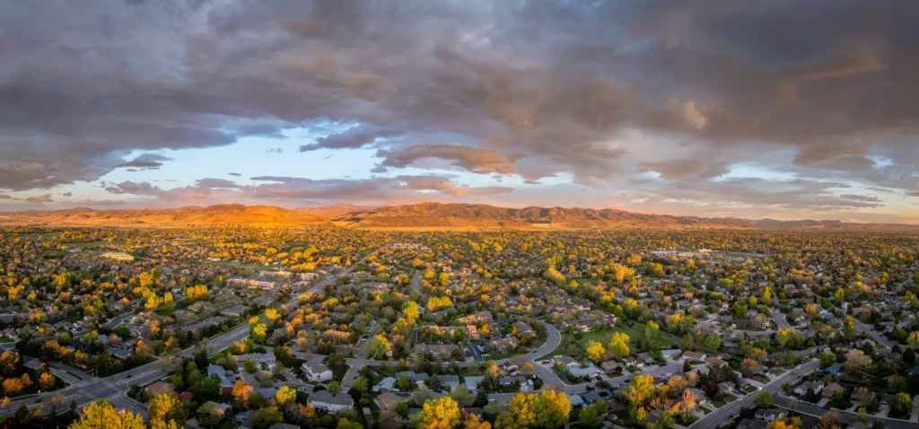
Professional Real Estate Photography Capture Stunning Aerial Images that Make your listing stand out
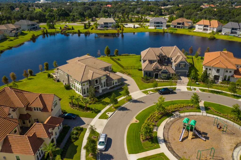
In the competitive Steamboat Springs real estate market, first impressions are critical. Our professional drone photography captures the full scope and beauty of your property, from the layout of the land to the stunning mountain views. We deliver high-impact photos and a compelling video sizzle reel that grabs the attention of potential buyers and helps them fall in love with the home before they even step inside. Elevate your listing and attract more qualified offers.
Attract More
Buyers
Listings with professional drone photography see significantly more engagement. Our captivating aerial shots highlight your property's best features, attracting more qualified buyers and generating higher levels of interest.
30- Second
Sizzle Reel
We include a dynamic, shareable video that captures the essence of the property. This "sizzle reel" is perfect for social media and online listings to grab immediate attention.
Show the Full Picture
Give potential buyers a true sense of the property's size, layout, and beautiful setting. Aerial photos show off the entire lot, landscaping, and surrounding neighborhood.
See how we can streamline your next real estate project
Additional Drone Services Commercial & Industrial Aerial Solutions
Using advanced radiometric thermal sensors, we make the invisible visible. These powerful tools detect minute temperature differences, allowing us to identify critical issues that would otherwise go unnoticed. For homeowners and property managers, this means pinpointing areas of significant heat loss, finding hidden moisture from leaks, and proactively addressing potential electrical hazards before they become dangerous. For commercial clients, we can efficiently inspect entire solar farms for faulty panels or assess large, flat roofs for integrity issues, providing the actionable data you need to save money, improve efficiency, and ensure safety.
Maintaining the safety and reliability of critical infrastructure is a monumental task. Our aerial inspection services provide a safer, faster, and more cost-effective alternative to traditional methods like bucket trucks or helicopters. We specialize in high-resolution imaging of transmission corridors, cell towers, and other vital assets, allowing us to identify potential issues like corrosion, line sag, or vegetation encroachment from a safe distance. By delivering clear and precise data, we help our clients prevent outages, maintain regulatory compliance, and protect their most important assets, all while ensuring the highest level of operational safety.
When every second counts, our aerial support services can be a powerful force multiplier for official first responder agencies. In coordination with ground teams, we provide rapid deployment to gain immediate, real-time situational awareness over vast, hazardous, or inaccessible terrain. Equipped with both high-resolution and thermal sensors, our drones can assist in locating missing persons, identifying hotspots in fire zones, and providing a critical overhead view to improve the safety and efficiency of ground crews. We are proud to offer our professional expertise as a trusted resource for the agencies working to keep our community safe.
Ground-level footage can only tell part of the story. We elevate your brand and capture the full scale of your event with breathtaking, cinematic aerial videography. Whether you’re creating a promotional video for a luxury real estate development, documenting a large-scale outdoor festival, or producing a compelling brand story, our high-resolution aerial footage provides a dynamic and captivating perspective that standard videography simply can’t match. We work with you to understand your creative vision and deliver a polished, professional video that will engage your audience and leave a lasting impression.
Move beyond flat blueprints and static photos by transforming your entire project site into a precise and interactive digital asset. Using advanced photogrammetry, we create survey-grade 3D models and “digital twins” that provide an exact virtual replica of your construction site, development, or existing infrastructure. These models empower architects, engineers, and project managers to track progress against plans with unparalleled accuracy, calculate volumes, and communicate with stakeholders using clear, immersive visuals. This technology bridges the gap between the digital plan and the physical reality, leading to more informed decisions and streamlined project execution.
Managing a large ranch or expansive property comes with unique challenges. Our comprehensive mapping service provides you with a complete, high-resolution “digital snapshot” of your entire land holding, giving you an unprecedented level of understanding and control. This detailed orthomosaic map is an invaluable tool for planning new infrastructure, monitoring vegetation health, tracking water resources, and documenting assets for insurance or estate planning. Instead of relying on outdated satellite images, get a clear, current, and detailed view of your property to make smarter, more effective management decisions.
Straightforward Pricing Transparent costs for professional-grade results
We believe in clear and uncomplicated pricing. For our specialized wildfire mitigation and construction services, we provide a custom quote based on the acreage and data requirements of your project. We outline our pricing for our popular services below. Feel free to reach out for a quote for other services!
Vegetation Mapping & Basic Photogrammetry
Starting at $100 per acre
- Minimum project cost: $500
- High-resolution orthomosaic imagery
- NDVI or RGB vegetation analysis
- Cloud-hosted data access or downloadable package
Real Estate Photography
Basic Package
$200
- Up to 5 professionally edited aerial photos
- 1 location within 20 miles of Steamboat Springs
- Delivery within 48 hours
Add-ons:
- Additional edited photos – $25 each
- 30-second property highlight video – $250
- Twilight or sunset shoot – $100
Construction & Survey Mapping, and additional services
Custom Quotes Only
Construction, volumetric, and survey-grade mapping projects often require specialized planning, data accuracy, and coordination with site managers. We provide tailored quotes based on:
- Site size and complexity
- Required accuracy (GCPs, RTK/PPK options)
- Data deliverables and report formats
Contact us to discuss your project scope, and we’ll build a custom proposal to fit your budget and technical needs.

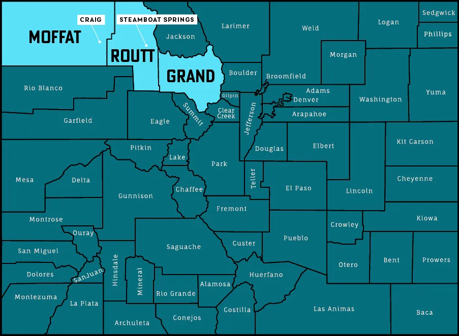
Proudly serving Northwest Colorado Your local drone service expert in steamboat springs and beyond
As members of this community, we are dedicated to serving our neighbors across Northwest Colorado. Our primary service areas include Steamboat Springs, the Yampa Valley, and the surrounding mountain regions within Moffat, Grand, and Routt counties. If your property is located just outside this area, please don’t hesitate to reach out. We are committed to helping our fellow Coloradans protect and manage their properties.

Ready to see your Property from a new perspective?
Every project is unique. Let’s have a simple, no-jargon conversation about your goals. We’ll listen to your needs and provide a clear, straightforward quote to get the job done right. Fill out the form to get started with a free consultation and quote.
Drone Services Frequently Asked Questions
Do I need to be on the property for the drone flight?
Not at all. As long as we have legal access to the property, we can complete the entire flight and data capture without you needing to be present. We handle everything.
How Long does it take to get my photos and report?
For standard real estate packages, the turnaround is typically within 48 hours. For more complex data processing and reporting, we will provide a clear timeline with your custom quote.
Why Can't I just use my own drone for this?
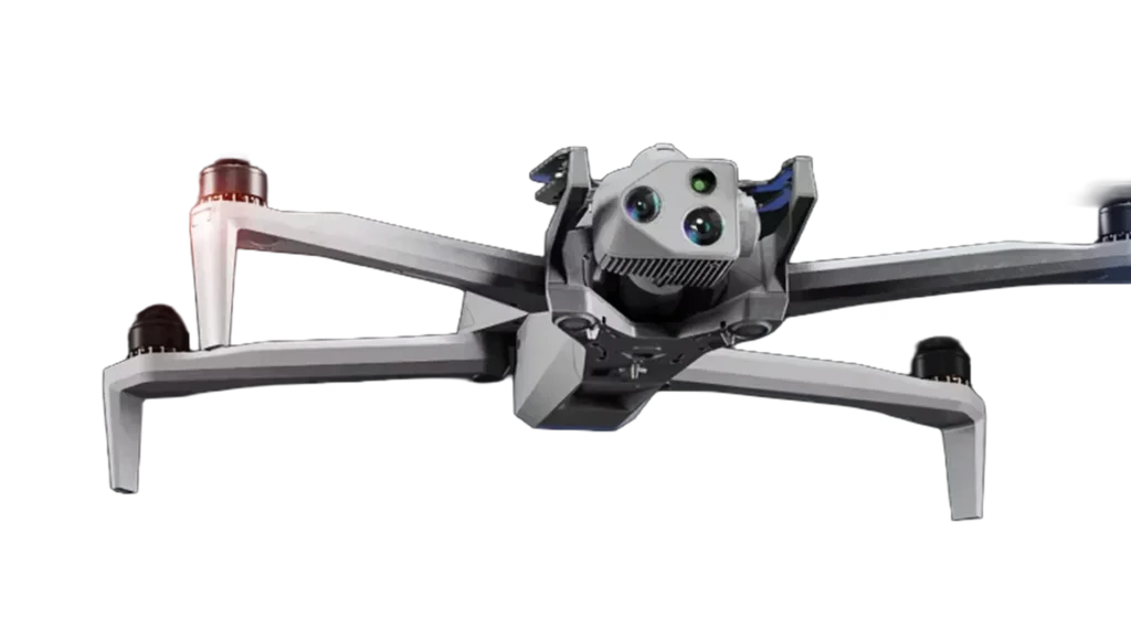
Beyond being FAA Part 107 certified, we use specialized, US-made drones and sophisticated software to turn hundreds of images into precise, actionable data reports and maps that a consumer drone cannot produce.
Is your service insured?
Yes, we are fully licensed and insured for all commercial drone operations. This protects you, your property, and your investment, providing complete peace of mind for every project.
How does mitigation photography help with my insurance?
It provides your insurance carrier with indisputable, time-stamped visual evidence that you have completed the required fire mitigation work, helping you secure or maintain your homeowner’s policy.